
Palisade Falls
Hiking distance: 1.2 miles round trip
Hiking time: 30 minutes
Elevation gain: 250 feet
Maps: U.S.G.S. Fridley Peak
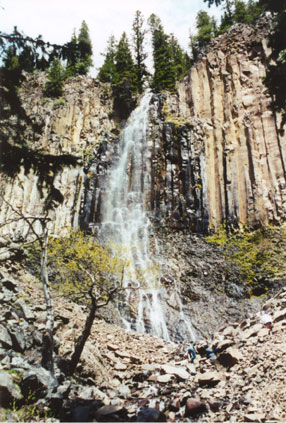
Summary of hike: The hike to Palisade Falls follows a paved wheelchair accessible trail. The forested trail parallels the East Fork of Hyalite Creek to a tall and beautiful waterfall on Palisade Mountain. The towering falls weaves a mosaic of white patterns cascading off the rocks below. At the trailhead is a picnic area. The trail has a “most difficult” rating for an accessible recreation trail. Four picnic sites and an outhouse are adjacent to the parking area.
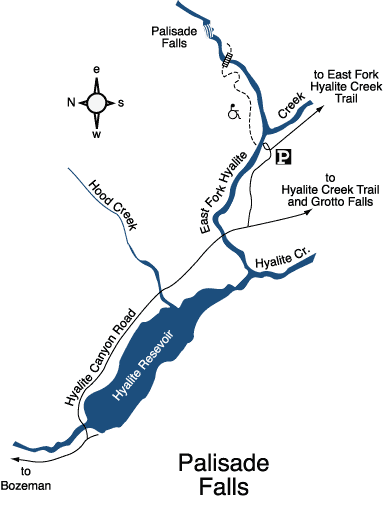
Driving directions: From Main Street and 19th Avenue in Bozeman, drive south on 19th Avenue, which becomes South 19th Road, 7 miles to Hyalite Canyon Road on the left, turn left. Continue 11.7 miles, crossing to the east side of Hyalite Reservoir, to a road fork. Take the left fork one mile to the Palisade Falls parking and picnic area on the left.
Hiking directions: From the parking area, follow the paved path to the east. The trail switchbacks up to a bridge that crosses the East Fork of Hyalite Creek. From the bridge is a stunning frontal view of Palisade Falls. To return, follow the same path back.
Palisade Falls