
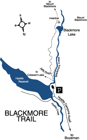
Blackmore Trail to Blackmore Lake
Hiking distance: 1 mile round trip
Hiking time: 40 minutes
Elevation gain: 80 feet
Maps: U.S.G.S. Fridley Peak, U.S.F.S. Hyalite
Drainage Map, Crystal Bench Maps–Bozeman, Montana
Summary of hike: The Blackmore Trail leads to Blackmore Lake at an altitude of 7,300 feet, then continues up to Mount Blackmore. The lake is surrounded by a dense pine forest, a meadow and the surrounding mountains of Mount Blackmore and Elephant Mountain. The trail begins at the west shore of Hyalite Reservoir. Picnic sites, boat ramps, accessible outhouses and drinking water are located here.
Driving directions: From Main Street and 19th Avenue in Bozeman, drive south on 19th Avenue, which becomes South 19th Road, 7 miles to Hyalite Canyon Road on the left, turn left. Continue 9.9 miles to the trailhead parking area on the right. Hyalite Reservoir is to the left.
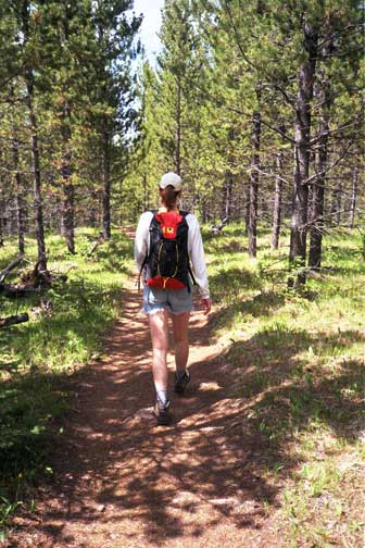
Hiking directions: From the parking area, take the signed Blackmore Trail to a log crossing over Blackmore Creek. Once over the creek, the path forks. The left branch leads to Crescent Lake. Stay on the Blackmore Trail bearing to the right. At 0.4 miles the trail crosses an old jeep road. The trail zigzags uphill through the forest, then levels out. As you near the lake, which is not within view, there is a short but steep descent that leads to the southeast corner of Blackmore Lake. The trail continues along the east side of the lake into a meadow where Blackmore Creek flows placidly. This is our turnaround spot. Return along the same trail.
To hike further, the trail continues 3 miles up to Mount Blackmore, then descends to South Cottonwood Creek.
On the Blackmore Lake Trail