
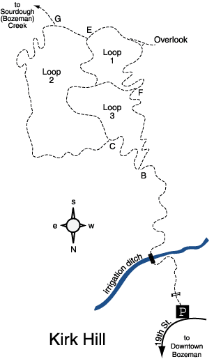
Kirk Hill—Loops 1, 2 and 3
Hiking Distance: 1.7 miles round trip
Hiking time: 45 minutes
Elevation gain: 600 feet
Maps: U.S.G.S. Wheeler Mountain Kirk Hill Nature
Trail Map
Summary of hike: Kirk Hill has three loop trails. All three loops are self–guided interpretive trails. The first hike follows a figure–8 pattern around Loops 1 and 3. At the top of Kirk Hill is an overlook with a panoramic map of the Madison Range identifying the peaks and canyons within sight. The trails are managed by the Museum of the Rockies and maintained by Kiwanis of the Bridgers.
Driving directions: From Main Street at the west end of Bozeman, drive south on 19th Avenue for 6.1 miles to the signed trailhead parking area on the left at a sharp right bend in the road. Turn left and park.
Hiking directions for Loops 1 and 3: Head south past the trailhead gate, and cross the grassy meadow. Head up the foothills through the shady forest, crossing the footbridge over the irrigation ditch. Switchbacks lead uphill to a signed junction at 0.5 miles. The left fork leads to Loop 2 (Hike 20). Take the right fork uphill to junction F. Bear left on the cut?across trail, and traverse the hillside on the near?level path to junction D. Head uphill to the right through the pine and fir forest, reaching junction E at the top of the hill. Go to the right, following the hilltop ridge past Rocky Mountain juniper. On the left is a short side path to a panoramic overlook of the Madison Range. Back on the main trail, begin the descent back to the cut?across trail at junction F. Bear right and traverse the hillside again to junction D. This time, bear left and descend through the forest to junction C. Bear left again, completing the figure?8 at junction B. Take the right fork downhill, returning to the trailhead.
Hiking directions for Loop 2: Take the left fork, weaving up the trail to junction C. Bear left, beginning the loop. Head east across the hillside through the forest of aspen, pine and fir. The path curves south and heads steadily uphill, including some short, steep ascents. Once at the top, the trail levels out and crosses the hilltop. Stay to the right past junction G which leads to Bozeman Creek, to a junction with Loop 1. Go to the right, returning downhill to the cut-across trail dividing Loops 1 and 3. Again stay to the right completing the loop at junction C. Go left, back to junction B. Take the right fork downhill, returning to the trailhead.
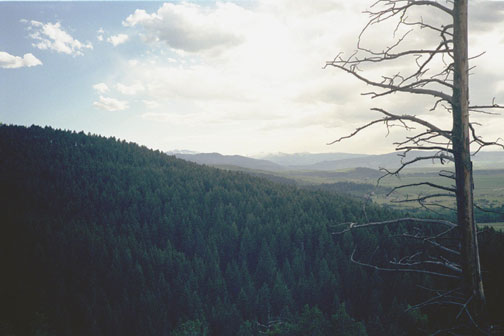
The view from the Kirk Hill overlook to the west
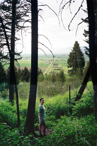
The view from Kirk Hill to the north